Thailand's stunning and varied landscape creates breathtaking scenery around practically every turn. It's hardly a surprise that most of the places on our list are right by the side of a tarmacked road as you could put a bit of road almost anywhere in the country – you’ll probably find 2 or 3 viewpoints along the way!
With rugged mountains in the north, jungle-covered hills in the middle, the glittering lights of the capital city, and then the sandy beaches of the islands towards the south, there’s something for just about every landscape photographer to enjoy in Thailand. We’ve picked out a selection of the very best viewpoints in Thailand, with each providing jaw-dropping vistas from elevated viewpoints.
- 1
Doi Inthanon
Chiang Mai

- Olcsó
- Történelmi környezet
- Kép
At the heart of the 482-sq-km Doi Inthanon National Park, to the west of Chiang Mai, the titular peak is Thailand’s highest, rising to 2,565 metres above sea level. Fortunately, you don’t need to be a mountaineer to enjoy the stunning view – there's a tarmac road right to the top, where you'll find a beautiful little garden and a couple of pagodas.
How to shoot: While the endless tracts of verdant hills make a breathtaking view at any time of the day, it's particularly striking at sunset, with the 2 pagodas silhouetted in the dimming light and the rugged landscape beyond turning blue with distance, looking like ripples on a pond.
Térkép - 2
Samet Nangshe Viewpoint
Phang Nga Bay
- Kaland
- Olcsó
- Kép
Több mutatásaSamet Nangshe Viewpoint has very quickly gone from being practically unheard of to one of the most popular panoramas in Phang Nga. Located on a hilltop just a 30-minute drive from Phuket, it provides stunning views over the limestone islets of Phang Nga Bay. Being far enough away from civilisation to avoid light pollution, the Milky Way is even visible at certain times.
How to shoot: Make sure you check online for when and if the Milky Way will be visible. After a couple of hours enjoying the beauty of the galaxy, the rising sun peeking between the tiny islands makes for further astounding pictures.
Térkép - 3
Khao Ngon Nak Viewpoint
Krabi

- Kaland
- Olcsó
- Kép
The trail to the summit of the Dragon Crest Mountain ('Khao Ngon Nak' in Thai) is approximately 4 km in length. It takes about 2.5 hours to reach the highest viewpoint, situated 565 metres above sea level. The climb is not that difficult, but only those in a decent physical condition should attempt it. Along the way, hikers encounter a stream, 2 viewpoints, a waterfall and, last but not least, the panoramic summit.
How to shoot: There's a famous jutting rock at the summit, from which you can enjoy a fantastic landscape of sheer rocky outcrops on the otherwise flat land. It's also the place you should sit for the iconic 'living life on the edge' picture, though you do so at your own risk.
Térkép - 4
Baiyoke Tower II
Bangkok

- Pároknak
- Családoknak
- Kép
Baiyoke Tower has been a prominent feature of the Bangkok skyline since its completion in 1998. Towering at 309 metres above the Pratunam area, the building offers excellent views of the surrounding city, which stretches out to the horizon in every direction.
How to shoot: The night shot from here, looking out east over the tangle of expressways, is a classic – shooting a timelapse video is also highly recommended. While the natural instinct is to go straight for the revolving observation deck on the 84th floor, you can get equally great views from the skywalk, located on the 77th level.
Térkép - 5
Nang Yuan Viewpoint
Koh Tao

- Olcsó
- Kép
Just off the northwest coast of Koh Tao, Koh Nang Yuan is a collection of 3 tiny islets linked by a sandbank. The white sandy beach is one of the best in Thailand, but is also one of the busiest, thanks to its immense popularity and small size. The southernmost of the 3 islets is where you get the best view, requiring a fairly easy 10-15 minute hike to get up to the rocky overlook.
How to shoot: Try to go either early in the morning or late in the afternoon to stand a better chance of seeing a deserted beach beneath you.
Térkép - 6
Northern Viewpoint Khao Yai
Khao Yai National Park

- Kaland
- Kép
The stunning Khao Yai National Park covers an area of 300 sq km, with plenty of breathtaking sights to see. With excellent tarmac roads, it's also very easy to explore and enjoy. The Northern Viewpoint Khao Yai is sometimes called Kilometre 30 Viewpoint – unsurprisingly because it's at the 30 km marker on Thanarat Road. With plenty of roadside car parking, it offers a great view of the verdant valley below.
How to shoot: While the midday sun offers the evenest lighting, dusk and dawn provide beautiful colours and more distinct contours, which will bring your pictures to life.
Térkép - 7
Karon Viewpoint
Phuket
- Olcsó
- Kép
Több mutatásaWhile Phuket has plenty of excellent vantage points, the Karon Viewpoint offers probably the most impressive sight. It's also known as the 3 Beaches Viewpoint as you can get 3 of Phuket’s best beaches in a single shot: Kata Noi nearest to you, Kata Beach in the middle and Karon Beach in the distance. You’ll also see Phuket’s Big Buddha on the hilltop to your right and the tiny Koh Pu to the left.
How to shoot: Most people take their pictures from the car park by the coast road, but there is an equally good view down the steps behind it, with the added bonus of fewer other people blocking your shot. You can get interesting shots here at almost any time of the day or night.
Térkép - 8
Phi Phi Viewpoint
Koh Phi Phi
- Olcsó
- Pároknak
- Családoknak
- Kép
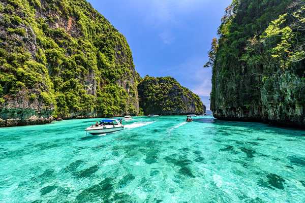
Több mutatásaPhi Phi Viewpoint offers an outstanding view across the islands, with the beautiful Loh Dalum Bay beneath you and Tonsai Village. While it’s a bit of a trek to get up to the viewpoint directly from the village, the route around the back is easier and there is a small café at the top.
How to shoot: It's best to shoot the view in the morning or at midday. That gives you the beautiful turquoise water in the bay, with the opposite cliffs nicely lit. Visit after 1pm and they'll be in deep shadow.
Térkép - 9
Lom Sak Cliffs
Phu Kradueng National Park

- Kaland
- Olcsó
- Kép
The viewpoint on the Lom Sak Cliffs has a rocky outcrop similar to that at Khao Ngon Nak Viewpoint, but with a massive tree growing right next to it. The rolling jungle-covered landscape below certainly makes for an impressive view – one of several in Thailand’s second-oldest national park. The park is in Loei Province, making it a little tricky to reach. The viewpoint itself, however, is right by a tarmac road, with a café nearby. Standing at an elevation of 1,316 metres, Phu Kradueng Mountain offers one of Thailand’s best trails. There's a very unique set of flora as well as herds of wild deer and elephants to see at the top.
How to shoot: Phu Kradueng National Park is closed during the rainy season, so plan your visit between October and May. Get there before sunset to get the best pictures as the light filters through the branches of that large tree.
Térkép - 10
Phu Chi Fa
Chiang Rai

- Kaland
- Olcsó
- Kép
The view from Phu Chi Fa isn’t actually of Thailand as the clifftop viewpoint is right on the border with Laos. Located about 90 km east of Chiang Rai City, it's one of the more remote viewpoints in Thailand. While it requires a bit of a trek to get there, the viewpoint is still very popular, particularly with locals. On a clear day, you get a fantastic view of the rugged countryside and the Mekong River valley. On a not-so-clear day, the 1,628-metre elevation puts you well above the clouds, making it quite a mysterious (if soggy) view.
How to shoot: Dawn is the most popular time to visit this viewpoint for a beautiful “sea of mist” effect.
Térkép


